Dursey Island Heritage Walk
There are an exceptionally large amount of historical landmarks to see on Dursey Island. In the map above, we have shown the location of some of the more visible ones. Additional information will be available inside the schoolhouse, should you choose to stay with us.
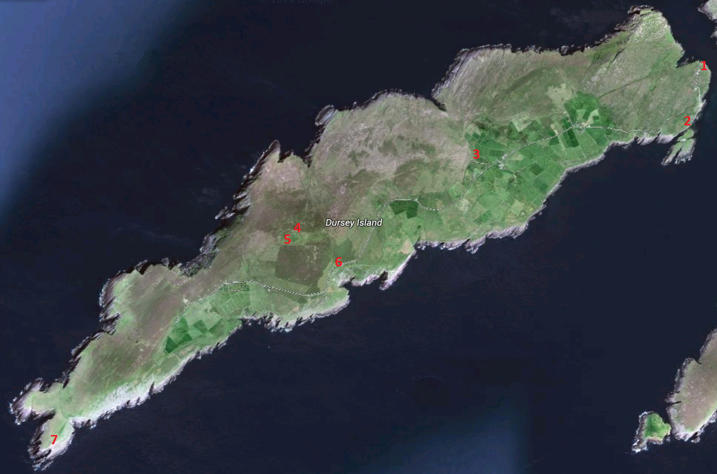
Site 1 is the landing place for the cable car from the mainland.
Site 1 is the landing place for the cable car from the mainland.
The landing area for the cable car at site 1.
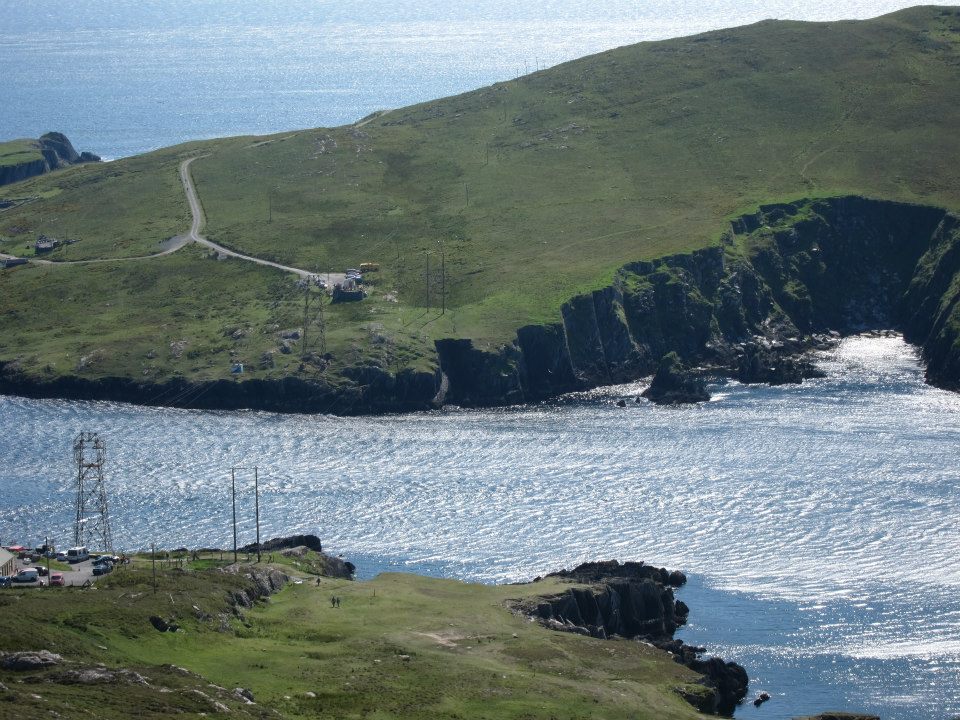
Site 2 is the location of the old monastery and graveyard. The monastery was said to have been built in the 16th century by a Spanish bishop by the name of Bonaventure. The graveyard was the burial ground for island residents for many years, but no new burials have taken place there in quite some time.
The monastery and graveyard at site 2.
Site 3 is the location of the Dursey Schoolhouse.
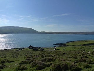
Site 4 is the location of the Dursey Island Signal Tower. Built in the early 19th Century as a means of communicating quickly up and down the south and west coasts of Ireland, they were to serve as a lookout system for any potential invasion by Napoleon Bonaparte, then relay this information back to major garrisons in larger towns and cities like Cork.
The south-west coast was thought to be particularly vulnerable, especially following the failed invasion attempt in Bantry Bay, just a few miles away, in 1796.
The south-west coast was thought to be particularly vulnerable, especially following the failed invasion attempt in Bantry Bay, just a few miles away, in 1796.
The signal tower at site 4.
Site 5, situated just a hundred metres northwest of the signal tower, is the location of the giant "Eire 32" sign, which served as a unique aviation identifier for Dursey Island for pilots in World War 2. It is written in large white stones.
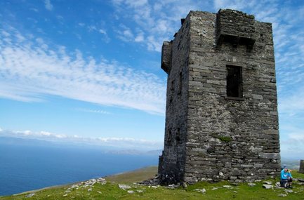
Site 6, The Needle's Eye. Sitting atop some of the most spectacular cliff tops on the whole island, this rock on the north side of the road, leans against the cliff, forming a passage just wide enough to admit a slim adult. The belief was that if a newly married woman passed through the gap three times in a east-west direction, she would never die in childbirth. This tradition was practiced as late as the 1930's.
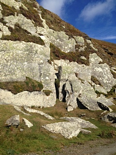
The Needle's Eye at site 6.
The Temporary Lighthouse at Site 7 was built on Dursey Head following the destruction of the lighthouse on the Calf Rock in the early 1880's. It was in use until the new lighthouse was built on the Bull Rock, which saw first use on January 1st 1889 and is still in use today. The ruins of the Calf Rock and temporary lighthouses are still clearly visible today as is the existing lighthouse on the Bull Rock.
The Calf Rock with ruined lighthouse in the distance and the end of
the island in the distance, site 7.